Home
Soda Canyon
Mountain Peak
Napa Soda Springs
The Caves
Relic
Meadowrock
Grassi
Rector Watershed
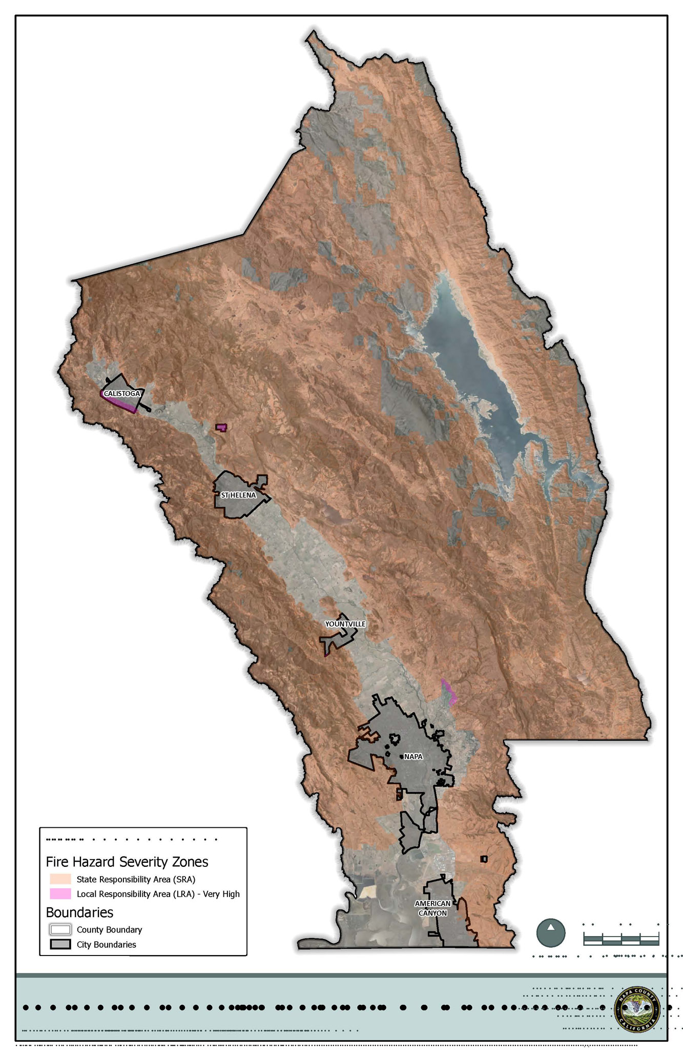
Fire Issues
The Hennessey FIre
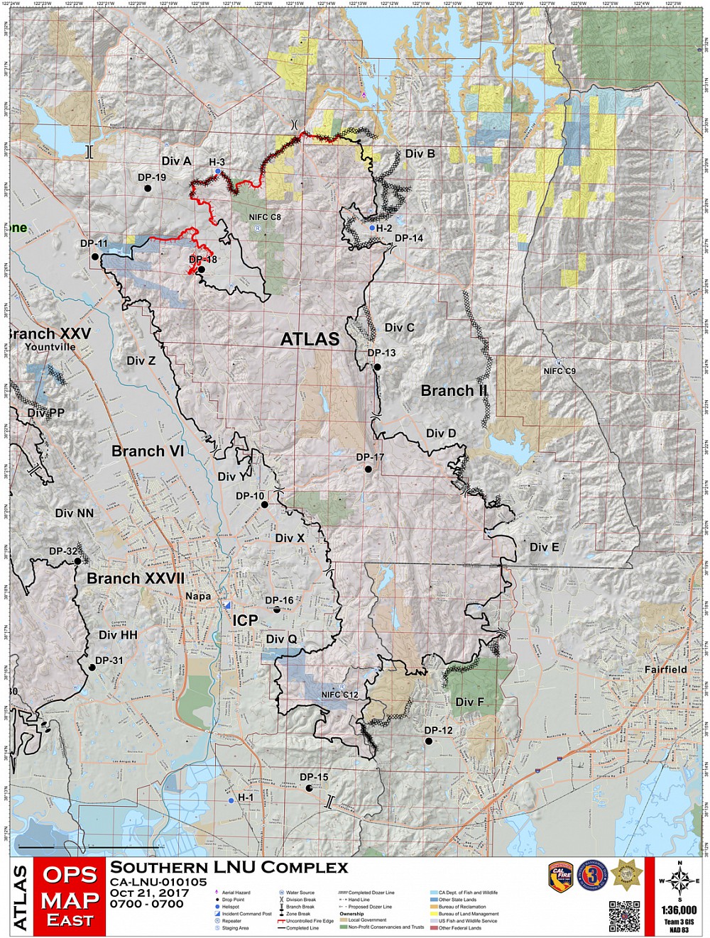
The Atlas FIre
After the Fire
Tourism Issues
The Hotel Binge
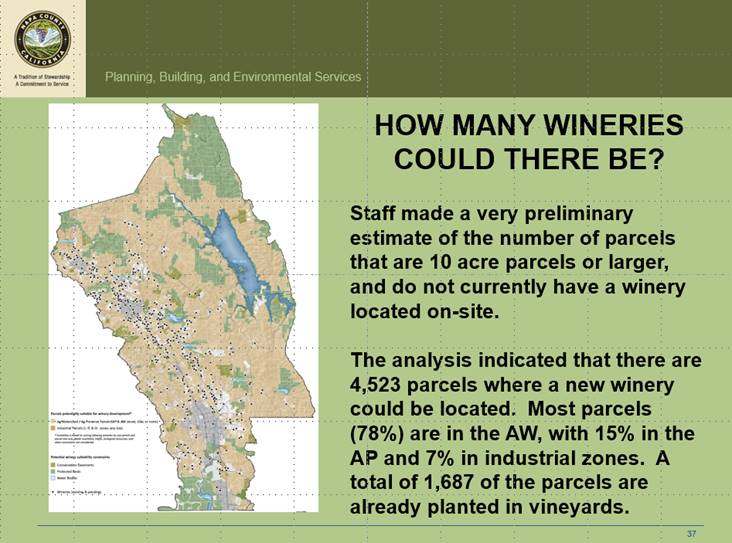
The Winery Glut The WDO
APAC
Remote Winery List
Remote Winery Ord.
Calistoga
St Helena
Soda Canyon
Mountain Peak
Napa Soda Springs
The Caves
Relic
Meadowrock
Grassi
Rector Watershed
Fire Issues
The Hennessey FIre
The Atlas FIre
After the Fire
Tourism Issues
The Hotel Binge
The Winery Glut The WDO
APAC
Remote Winery List
Remote Winery Ord.
Calistoga
St Helena
Growth Issues
New Development List
Napa Strategic Plan
Climate Action Plan
Affordable Housing
Solar Farming
Napa City
South Napa Co Heliport Measure D
Palmaz Heliport
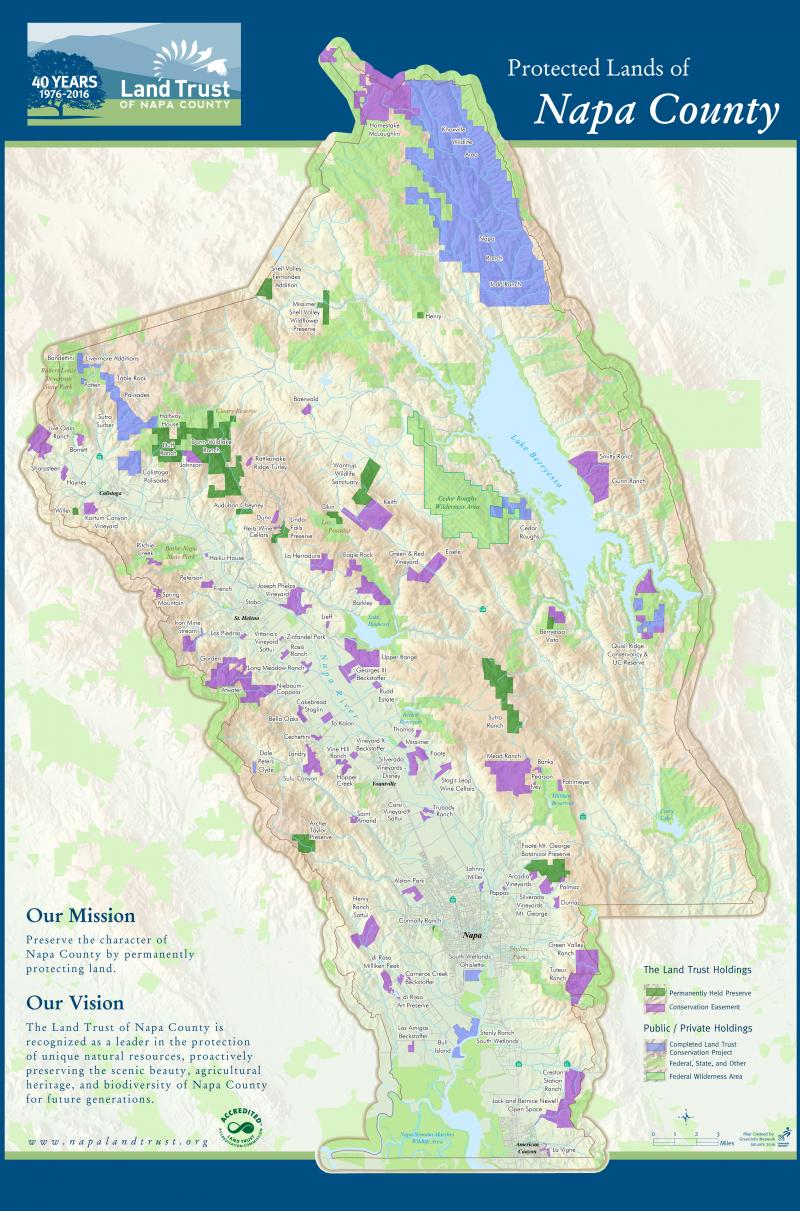
Watershed Issues
New Vineyard List
Conservation Regs
Measure C
Rector Watershed
Walt Ranch
Compliance Issues
Solutions
Open Comments
New Development List
Napa Strategic Plan
Climate Action Plan
Affordable Housing
Solar Farming
Napa City
South Napa Co Heliport Measure D
Palmaz Heliport
Watershed Issues
New Vineyard List
Conservation Regs
Measure C
Rector Watershed
Walt Ranch
Compliance Issues
Solutions
Open Comments
Community Groups
KNGG
Napavision 2050
Napavision 2050 pre 2018
Protect Rural Napa
St Helena Window
St Helena Post
Save Napa Valley
Save Rural Angwin
Sonoma County
Calendar
Resources
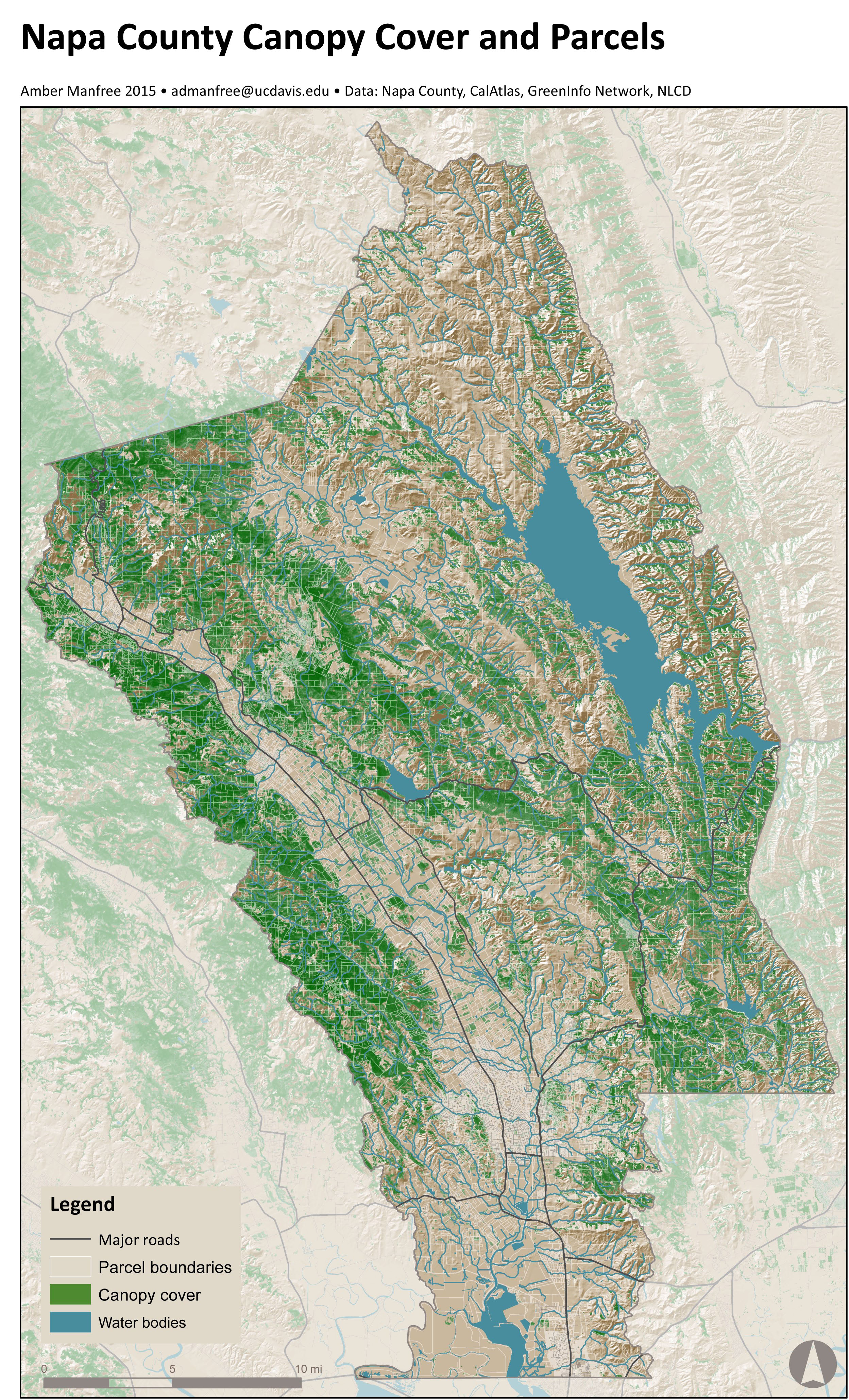
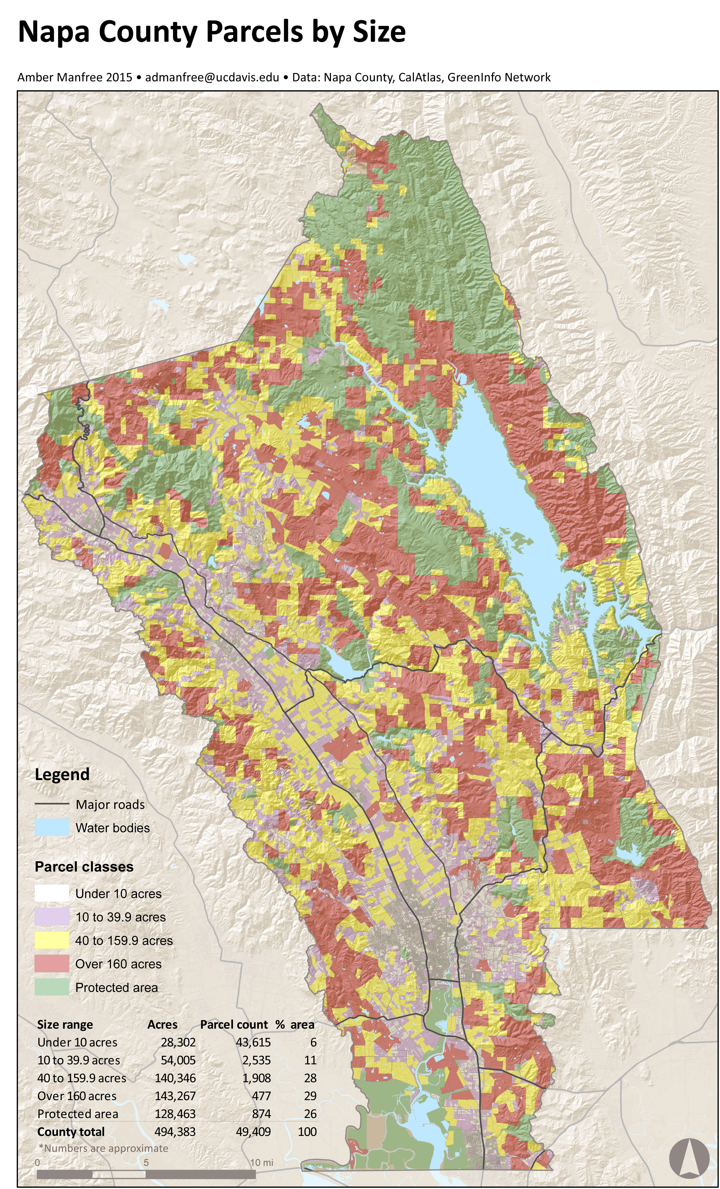
Maps
Send a Letter
About Us
Log In
KNGG
Napavision 2050
Napavision 2050 pre 2018
Protect Rural Napa
St Helena Window
St Helena Post
Save Napa Valley
Save Rural Angwin
Sonoma County
Calendar
Resources
Maps
Send a Letter
About Us
Log In