Feb 2, 2015

Maps


Maps are an important, perhaps the most important, way to look at land use issues, and the county zoning map has been principal representation of the ordinances used to protect the agricultural economy these last 45 years. Other maps are beginning to crop up in this discussion of the future of Napa county and I will start putting them all in one place here.

Additional interactive maps on the site:
SCR Map and table of all development in the valley (dormant)
SCR Map and tables of winery use permits approved and under review
(dormant)
SCR Map and table of new vineyards under review in the county
(dormant)

Napa County on Google Maps
County Districts Map

Posts


You must log in to add comments | Share this topic
23 comments


Napa Soda Springs Property Map


Bill Hocker - Nov 10, 2022 10:27AM  Share #2289

In 2022 RH, formerly Restoration Hardware, purchased the Napa Soda Springs property with the intent to revive, and probably expand, the resort that existed there at the turn of the 20th Century, the ruins of which still exist today. The corporate entity of the project is called 1990 Soda Canyon Road LLC.

Amber Manfree has created a map of the property showing it's developable areas.

SCR will be covering the development of this project on this page. It has the potential to generate as much concern as the Walt Ranch project has.


Urbanization of the Ag Preserve


Amber Manfree - Jun 30, 2021 8:29AM  Share #2234

When does preservation not mean preservation? When building projects and parking lots are called "agriculture".

Bay Area Ridge Trail in Napa County


Bill Hocker - Jan 22, 2019 12:06PM  Share #1984


click to enlarge
NVR 1/19/19: Napa's Ridge Trail still taking shape after 30 years

(With a slightly mislocated Atlas Peak)

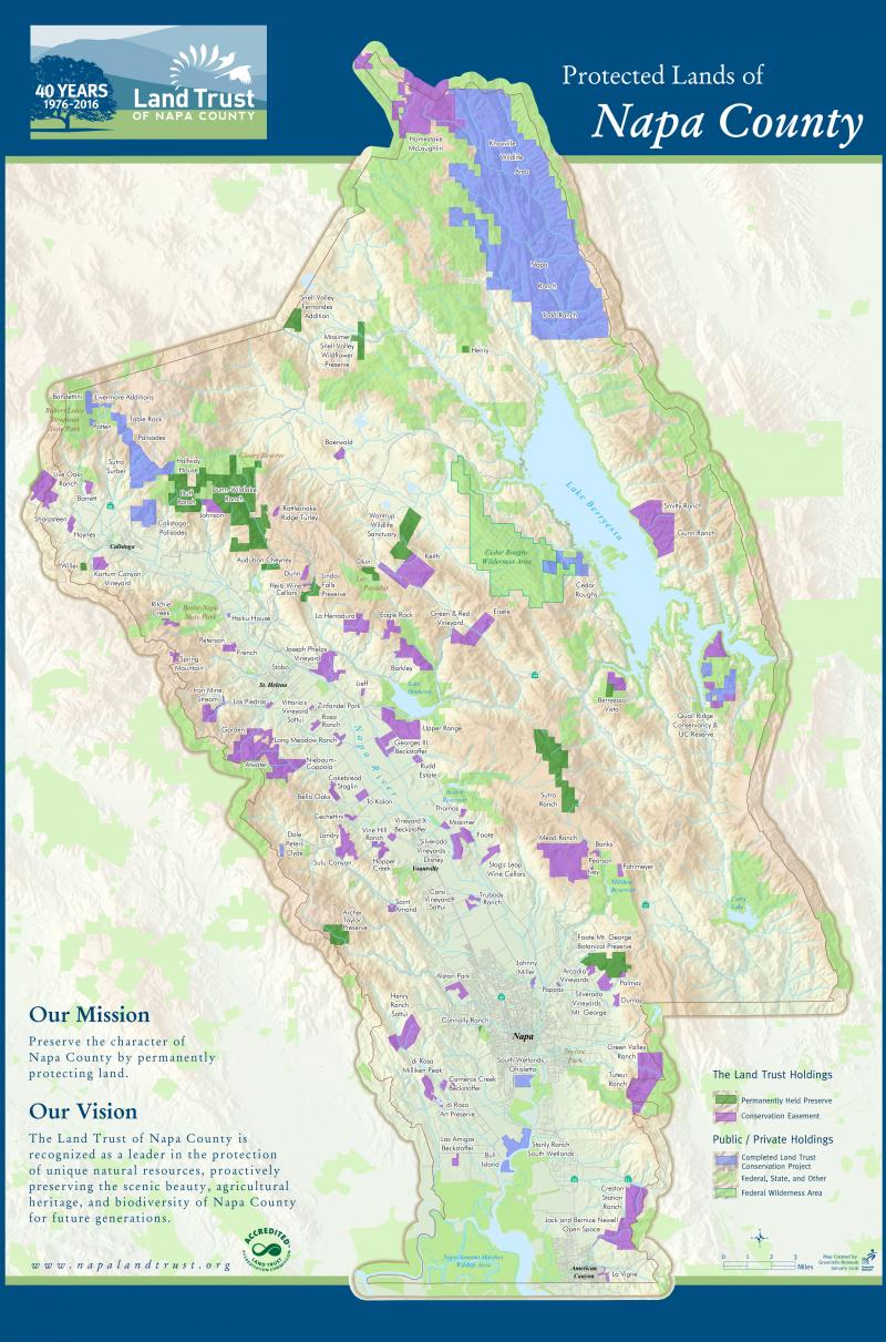
Napa County Land Trust Map


Bill Hocker - Nov 14, 2018 10:32AM  Share #2048

Click to enlarge
The Land Trust was produced by an outside contractor, Greening.org. I'm not sure whether or not they continue to update it.

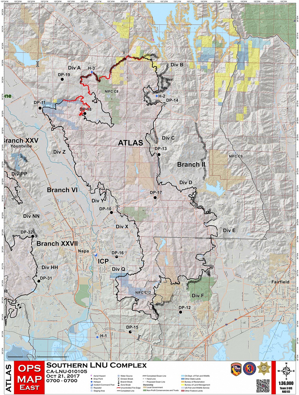
Atlas Fire Maps


Bill Hocker - May 27, 2018 5:18AM  Share #2028

2017 Atlas Fire maps showing the extent, progression by day, and sequence of reopening areas to residents. The deep indentation in the upper edge of the fire line encircles the whole of the residences on the Foss Valley Plateau at the end of Soda Canyon Road


The Rector Watershed


Amber Manfree - Dec 14, 2015 8:15AM  Share #1137


More Napa vineyard/winery info than you will ever need


Amber Manfree - Oct 27, 2015 12:03PM  Share #1061

..one more find I just turned up - a map designed for wine makers that shows locations of vineyards with grapes available for purchase. Not directly helpful in any way that's obvious, but a really interesting project nonetheless.

EveryVine.com Napa region online map

Bill Hocker adds:

The hoard of information given each and every vineyard block in the county is mind-numbing. Wine freak meets database freak.

Napa's 700 Wineries


Amber Manfree - Aug 11, 2015 6:51AM  Share #939

The map below is not mine - just something I found on the internet. They might be using the free, open source dataset from David Thompson's Napa Wine Project website
which lists 1,100+ commercial wine producers in Napa. Even Draselle's place is in their list, so a lot of that may be low-impact, small places that happen to have a permit.


Geoff Ellsworth's Map of Potential Wineries


Bill Hocker - Apr 21, 2015 3:17PM  Share #588

Update 5/4/21
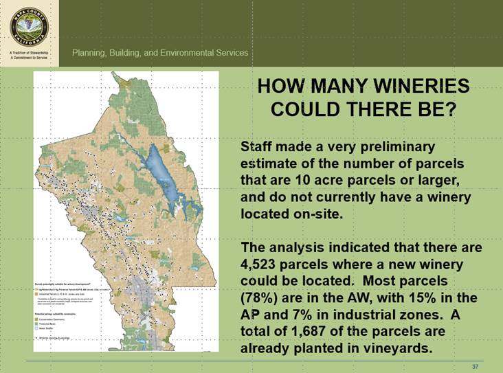
Kelli Anderson sent over an email from her archives in which Planning Director Morrison supplied a map from 2015 of legally potential winery development in the County, a worst case scenario that should have been analyzed in an EIR at the time of the WDO in 1990 or with the General Plan EIR in 2007.


On Tue, May 4, 2021 at 4:56 PM Morrison, David wrote:

    Kellie,

    During the Joint Board of Supervisors/Planning Commission meeting on March 10, 2015, the slide provided below was included in my presentation:

    The estimate provided was based on GIS analysis performed by County staff. It looked at all existing parcels (in 2015) that met the following criteria:

    · Unincorporated area;
    · No existing on-site winery;
    · A minimum of 10 acres in size for parcels zoned AW or AP; or all parcels without a winery zoned I, IP, or GI; and
    · Excluded conservation easements, protected lands, and water bodies.

    No other factors were considered such as traffic, fire, biological resources, water availability, slope, earthquake faults, utilities, etc.

    Of course, the County could not approve 4,523 new wineries. The current General Plan Program EIR only analyzed a total of 225 new wineries between 2005 and 2030. To date, 138 new wineries have been approved since January 1, 2005. To allow more than 225 new wineries would likely require a new Program EIR.

    David


Original Post 10/2/14

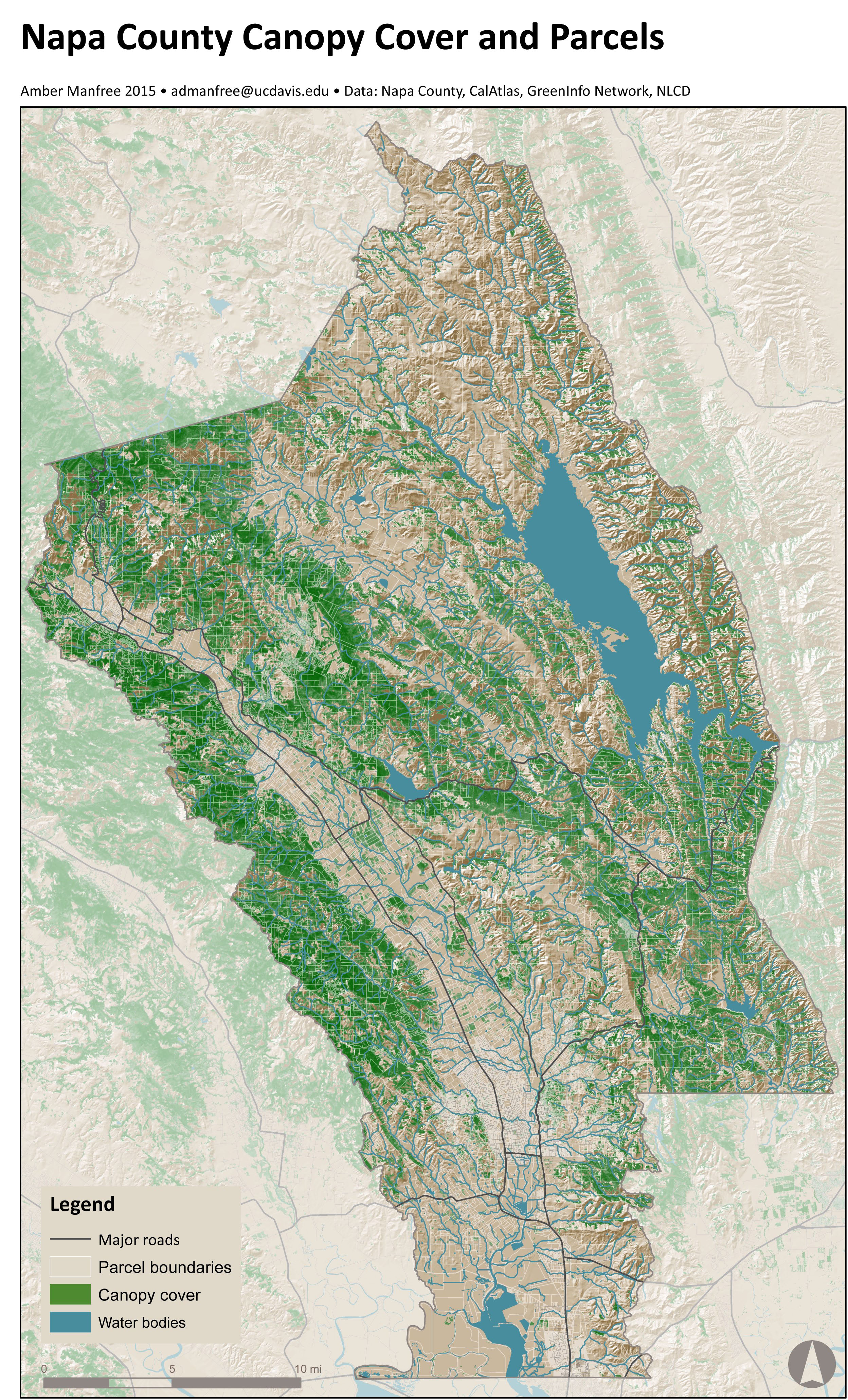
Napa County Woodland canopy


Amber Manfree - Feb 27, 2015 3:19PM  Share #775


Map prepared by Amber Manfree


Share this topic